
Chehalis River Town at the Forest's Edge
Listings in Oakville, WA
Welcome to Oakville, a small Grays Harbor County city on the Chehalis River, set between the Capitol State Forest and the Chehalis Reservation.
Oakville is a compact city in Grays Harbor County, Washington, on the north shore of the Chehalis River just downstream from where the Black River joins it. Incorporated in 1905, the community grew out of the lumber, railroad, and farming economy of the lower Chehalis Valley. Early settlers reached the area by way of the river system, entering from Grays Harbor and working inland along the Chehalis, and the arrival of the Northern Pacific Railway around 1890 brought a train station, stores, a school, and hotels to what had been a small prairie town. The name Oakville, chosen for the post office in 1873, honors the Garry oaks that grow in the area. Today Oakville remains a small, rural city of roughly 715 residents spread across less than a square mile. The hills of the Capitol State Forest rise to the north, while the Chehalis Reservation of the Confederated Tribes of the Chehalis lies to the east, and the two rivers shape both daily life and the local floodplain. U.S. Highway 12 runs through town, connecting it westward toward Aberdeen and east toward Interstate 5 near Tenino and Grand Mound. The local economy reflects the town's small scale: a grocery, a few diners, an organic bedding manufacturer, an auction house, and a chip plant, along with farms on the outskirts. Community life centers on an Independence Day parade, the Zucchini Jubilee, a harvest festival, and a grange hall known for its oyster dinner. Students attend the Oakville School District, which operates one elementary, middle, and high school, and a voter-approved bond funded a new elementary building. Recreation is immediate and varied: boating, fishing, and swimming on the Chehalis and Black rivers, and hiking, hunting, camping, horseback riding, and mountain biking in the Capitol State Forest. The Oakville Regional Event Center hosts rodeos and adventure races, and Al Brandt Municipal Park provides playground and picnic space near city hall. Major floods in 1996 and 2007 were federally declared disasters, a reminder that the riverside setting brings both recreation and occasional high water.

Get more information about Oakville
Houses in Oakville, WA

Lots & Land in Oakville, WA
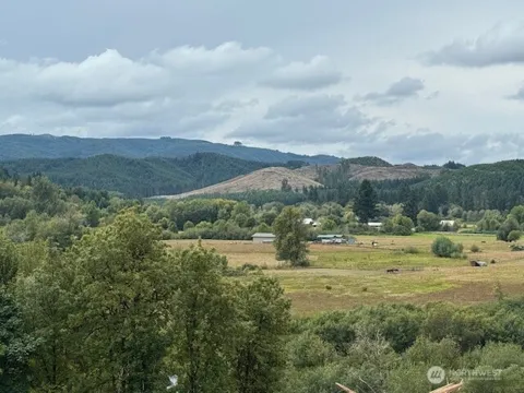
Farms & Ranches in Oakville, WA
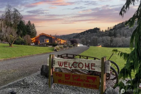
MARKET SNAPSHOT
The Market at a Glance
How homes have been selling here over the last 90 days.
Price & Sales History
Market data reflects closed sales over the last 90 days and is provided for informational purposes.
Zip Codes
BROWSE BY ZIP
Browse listings by postal code in this area.
- Grid
- Map
- List
City Guide
About Oakville
Real Estate & Housing
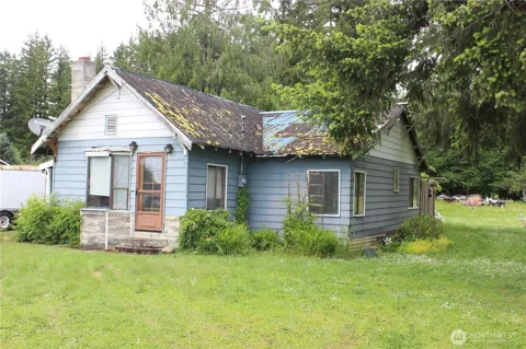
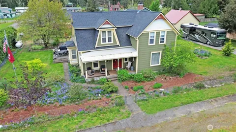
Oakville's housing stock is compact and small-town in character, reflecting its origins as a railroad and lumber community. The town itself covers less than a square mile, with modest single-family homes on small in-town lots clustered near U.S. Highway 12 and city hall. Older, early- to mid-20th-century homes sit alongside later infill, and a portion of the housing has long served the farming and working families of the Chehalis Valley. Beyond the city limits, larger rural parcels, small acreage, and farm properties spread into the surrounding bottomland and the lower slopes toward Capitol State Forest. Because the city sits on the Chehalis River floodplain, buyers weighing riverside or low-lying sites typically take flood history into account. The setting favors those seeking a simple, established home in a quiet river town rather than large-scale subdivision development.
Neighborhoods
Oakville is small enough that it is understood as a single community rather than a collection of named neighborhoods. The town center runs along U.S. Highway 12, where city hall shares a building with the Timberland Regional Library branch, and the school campus, park, and fire department sit within a few blocks. Residential streets fan out from that core toward the Chehalis and Black rivers on the south and the rising timbered ground to the north. The Chehalis Reservation borders the city to the east, and the rural outskirts blend quickly into farms, bottomland, and forest, giving many homes an open, semi-rural feel just minutes from the center of town.
Lifestyle in Oakville
Life in Oakville moves at a small-town pace shaped by the river, the forest, and the agricultural calendar. The Sharon Grange, founded in the 1920s, remains a social anchor and is known for its annual oyster dinner, while the city's calendar includes an Independence Day parade that closes a stretch of U.S. Highway 12, the summer Zucchini Jubilee, a harvest festival, and holiday tree lightings and egg hunts. The Confederated Tribes of the Chehalis Reservation, which borders the city, contributes to the area's cultural fabric. Residents gather at the grange hall, the event center, and the riverside park, and the town's scale means neighbors tend to know one another. Shopping and larger services are a drive away in Aberdeen or the Centralia–Chehalis area.
Schools & Education
The Oakville School District serves the city with a single elementary, middle, and high school on one campus system, and the district is small enough that students move through the grades together. A voter-approved bond funded a new elementary building that opened in 2022, along with upgrades to the high school and the addition of a preschool program. The district serves a few hundred students and employs a compact staff typical of rural Washington districts. For families seeking a broader range of programs, the larger districts of Aberdeen, Centralia, and Chehalis are within commuting distance, while the nearby Chehalis Reservation supports its own educational and cultural services for tribal members.
Getting Around
U.S. Highway 12 is Oakville's main corridor, running east–west through town along the Chehalis River valley. It connects the city westward toward Aberdeen and the Grays Harbor coast, and east to Interstate 5 near Grand Mound and Tenino, from which Olympia and Centralia are a short drive. The surrounding countryside is rural two-lane country, and the nearest rail service is the freight line that follows the valley. Residents typically rely on personal vehicles; the town's small footprint makes most in-town trips walkable, while commuting to Aberdeen, Olympia, or Centralia means a drive along U.S. 12 and connecting routes.
Parks & Recreation
The Chehalis and Black rivers define outdoor life on the south side of town, with boating, fishing, and swimming popular in the warmer months. To the north, the Capitol State Forest offers thousands of acres for hiking, hunting, camping, horseback riding, and mountain biking, with trailheads a short drive from city limits. Al Brandt Municipal Park, across from city hall, provides a playground, picnic shelter, and basketball court, and the Oakville Regional Event Center hosts rodeos and adventure races. The riverside setting also makes the area a base for kayaking and canoeing, while the broader Grays Harbor and Olympic Peninsula destinations are within a day trip.
About Oakville
Frequently asked questions
What county is Oakville in?
Oakville is in Grays Harbor County, Washington, on the north shore of the Chehalis River where it meets the Black River. It sits in the rural lower Chehalis Valley, with the Capitol State Forest rising to the north and the Chehalis Reservation bordering the city to the east.
What school district serves Oakville?
The Oakville School District serves the city with one elementary, middle, and high school. A voter-approved bond funded a new elementary building that opened in 2022, along with high school upgrades and a preschool program.
How far is Oakville from Aberdeen and Olympia?
Oakville sits on U.S. Highway 12, which runs west toward Aberdeen and the Grays Harbor coast and east to Interstate 5 near Grand Mound and Tenino. From there, Olympia and Centralia are a short drive.
What outdoor recreation is near Oakville?
Boating, fishing, and swimming are available on the Chehalis and Black rivers, while the Capitol State Forest to the north offers hiking, hunting, camping, horseback riding, and mountain biking. Al Brandt Municipal Park provides a playground and picnic shelter in town.
Does Oakville experience flooding?
The city lies on the Chehalis River floodplain, and major floods in 1996 and 2007 were federally declared disasters. Buyers considering low-lying or riverside sites often weigh flood history, though much of the town sits above the typical high-water line.
Still have questions about Oakville?
Get in touchExplore the area
